Task
Create a software system that will integrate the drone route, field data, computer vision, GIS map, analytics and processing tasks.
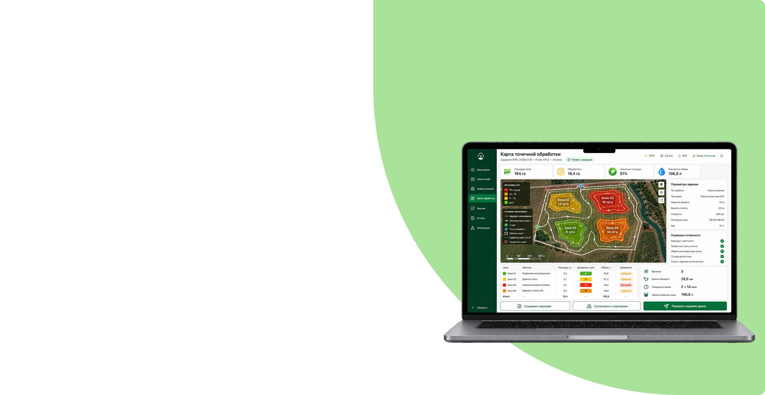
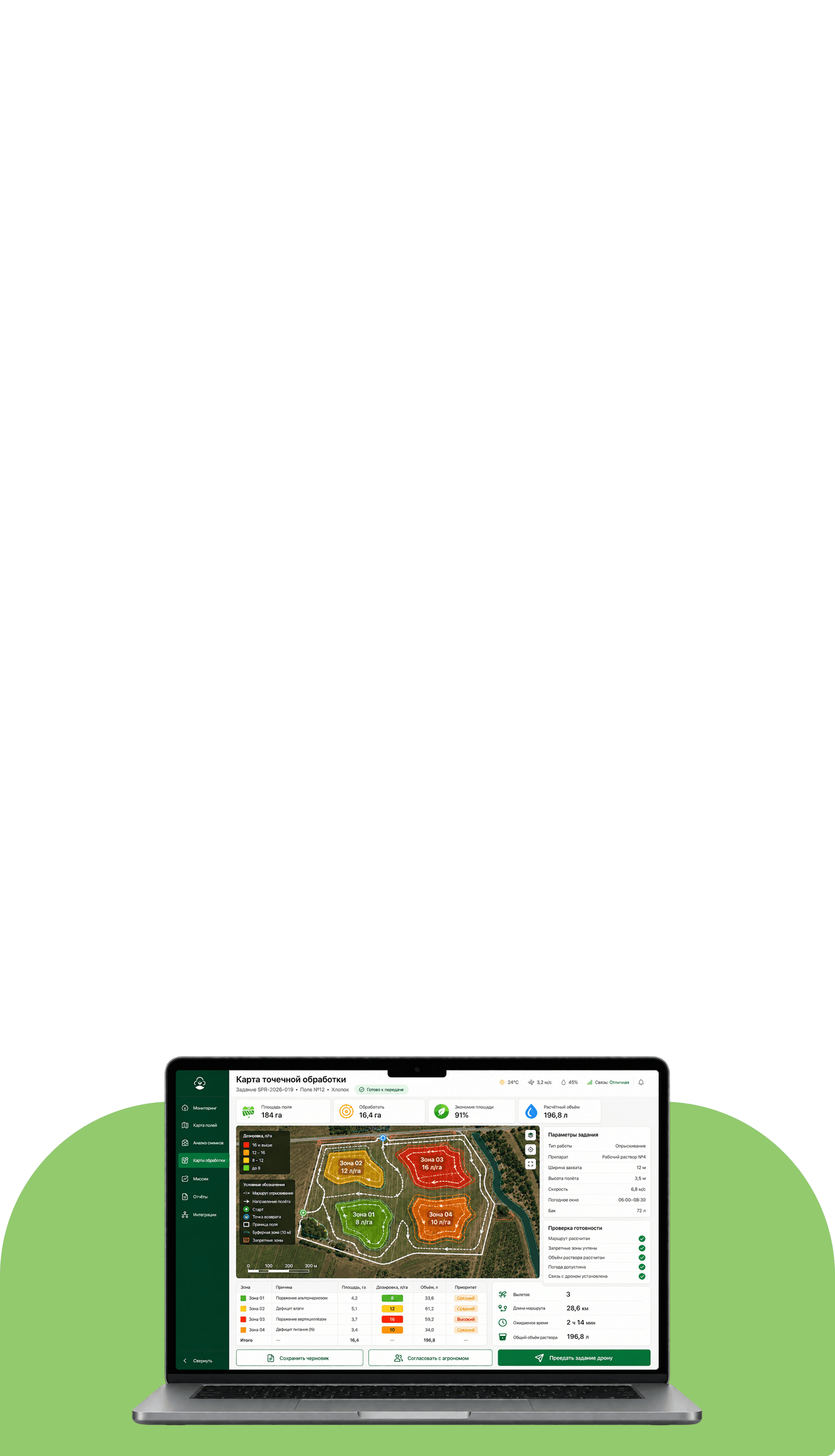
We have developed an interface and software circuit for the agricultural drone: the system receives images and telemetry, analyzes the state of crops, shows problem areas on a GIS map and helps generate tasks for spot processing
The project was created to monitor agricultural land and perform spot treatment. The agrodrone operates along a given route, collects data in the visible and infrared range, and the software system turns it into a clear map of the condition of crops and soil.
Create a software system that will integrate the drone route, field data, computer vision, GIS map, analytics and processing tasks.
We designed interfaces, data processing logic, field status maps, point processing maps, reporting and exchange with agro-ERP.
Agronomists, dispatchers, heads of agricultural holdings, farms, cooperatives and agricultural services.
Drone data has become a working tool for decision making, rather than a collection of individual images and files.
Flying over a field alone does not solve the agronomist’s problem. Images need to be linked to coordinates, compared between spectra, deviations identified, the area of the problem assessed and an understanding of where inspection or processing is required.
Tell us about the project — we will break down the task and propose an implementation approach.
DevSymfony was responsible for the digital part of the solution - from receiving data from the drone to operational interfaces, analytics and integrations.
Routes, flight status, telemetry, field coverage and event log.
Identify signs of disease, lack of moisture and uneven growth.
Linking results to coordinates and displaying field state layers.
Comparison of missions, cultural dynamics, events and history by site.
Exchange with drone API, agro-ERP, data warehouse and BI circuit.
Formation of zones and parameters for targeted application of drugs.
The architecture separates the field, airborne, integration and user levels. This allows you to process part of the data on the drone, transmit events to the platform and use the results in existing agricultural systems
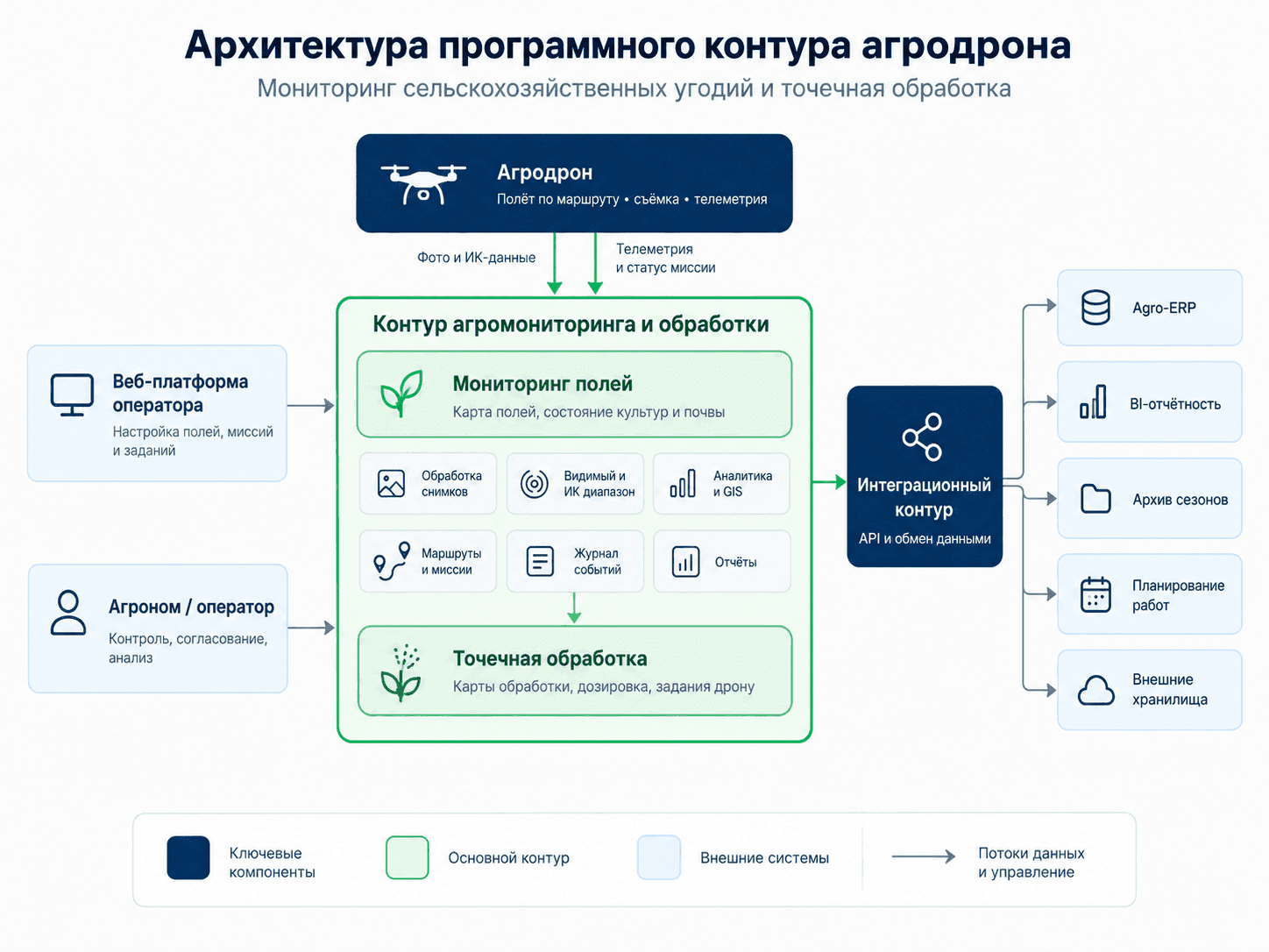
We will show how to connect interfaces, business logic, data and external systems.
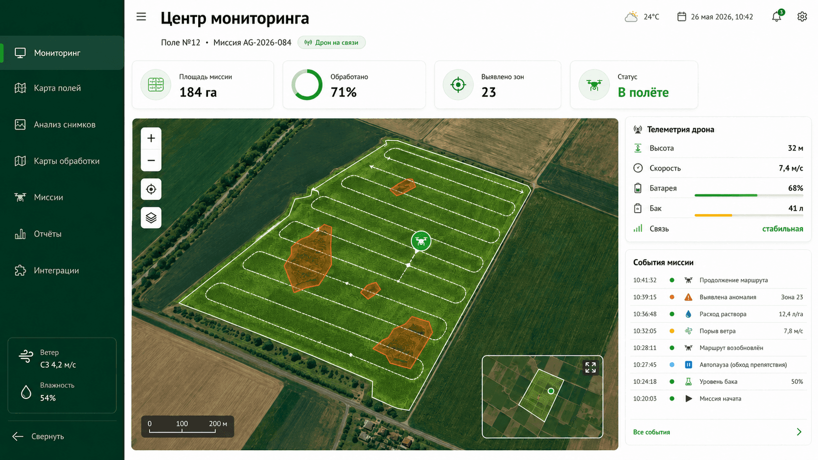
The operator sees the route, mission progress, telemetry, battery and tank levels, problem areas and flight events on one screen.
The GIS interface integrates layers of crop health, moisture and soil. An agronomist can select a problem area and see its area, type of risk and confidence of the analysis.
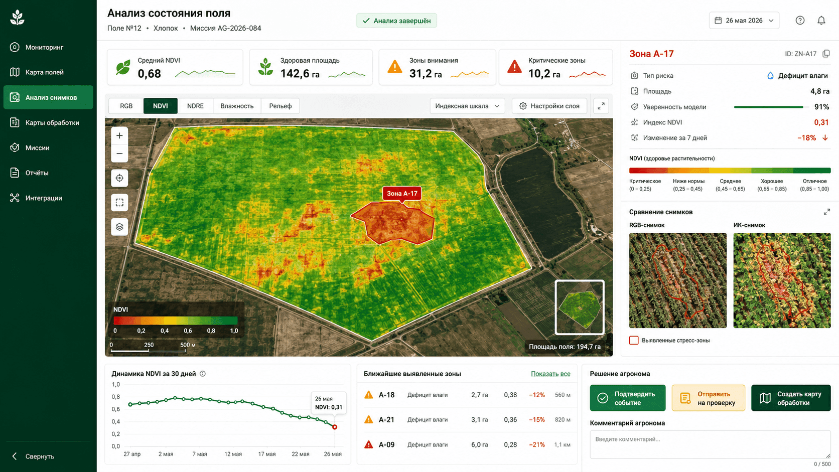
The system shows the source frame, the selected anomaly, coordinates, area, event type and model confidence. The specialist confirms the result before further action.
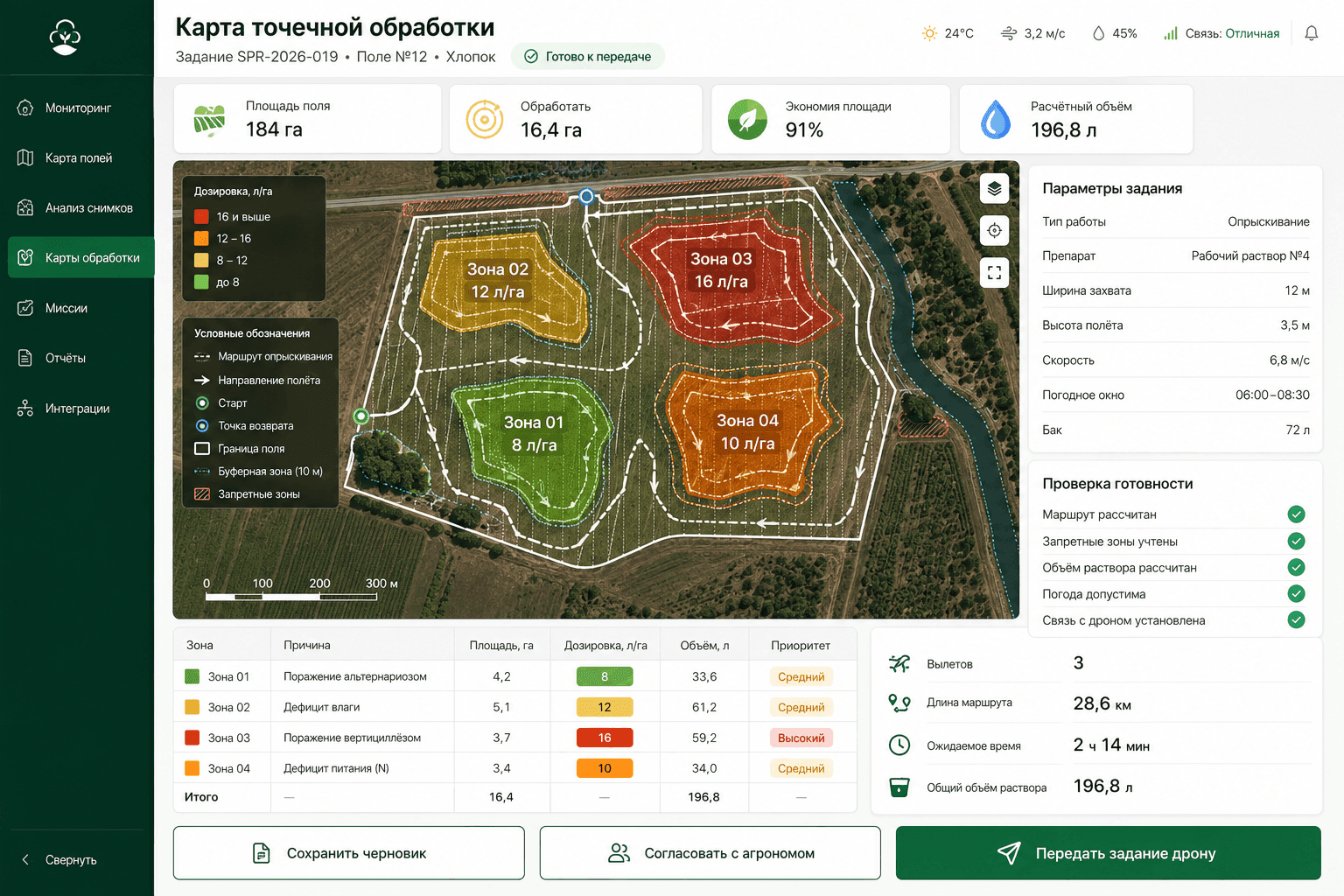
We will analyse the functionality and build a clear interface structure.
Defining goals, studying the audience, forming requirements and setting tasks. This helps to understand what the business needs and what results are expected.
Creating the solution architecture, thinking through user scenarios, interfaces and logic. At this stage the 'framework' of the future product is formed.
Programming the server and client parts, connecting databases, integrating with external services. This is where the idea turns into a working product.
Checking functionality, performance, compatibility and security. Fixing bugs before the product reaches users.
Deploying the product (for example, publishing in stores or launching on servers), configuring the environment and starting marketing or internal processes.
Updating functionality, adapting to new business tasks, fixing bugs and keeping the product up-to-date.
Missions, images, telemetry and coordinates are combined in one outline.
Computer vision highlights potential anomalies for inspection by a specialist.
The GIS map shows normal, observation and critical risk zones.
Reports and archive allow you to compare fields, missions and cultural dynamics.
We will propose a suitable structure and prepare the first sketch of your future project — with no obligation to start development.
You get a visual concept you can discuss with your team.

He will review your project and business objective, prepare recommendations and the first sketch.
An honest conclusion.If the solution can be improved without a full rebuild, we will tell you so.